Waymark
Waymark adds powerful mapping features to WordPress that are easy to use. Create beautiful, interactive Maps customised to suit your needs.
+6
Overview
Compatibility
Installation instructions
Customer support & learning resources
Changelog
Main benefits
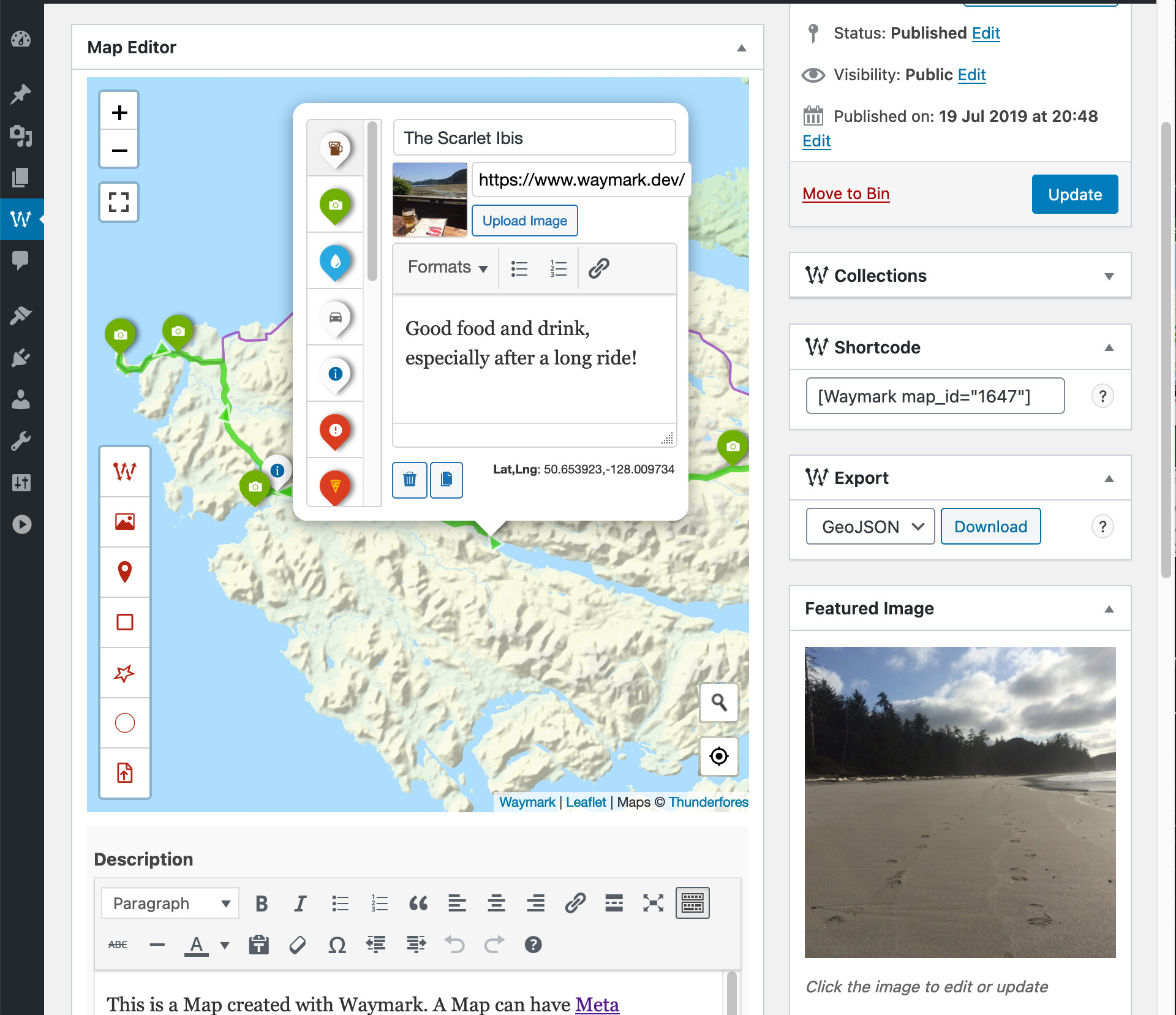
Intuitive map editor
Supports multiple data formats
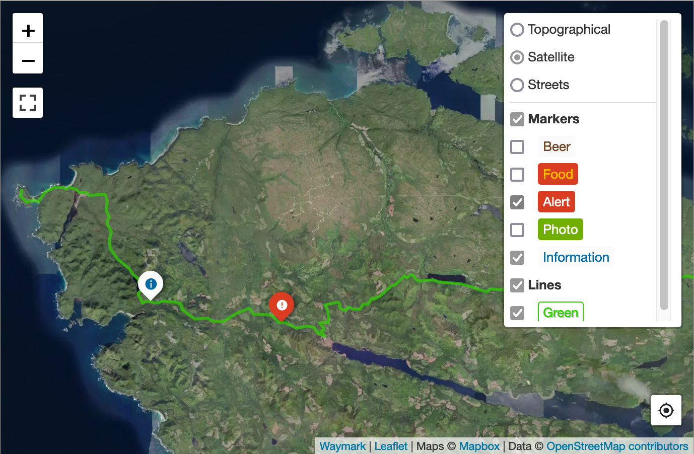
Customizable map overlays
User submissions enabled
Flexible display options
About this plugin
Author: Joe
Categories: Content Management
Version: 1.3.2
Last updated: 23-06-2024
WordPress version: 4.6
Tested up to: 6.5.5
PHP version required: 5.2
Languages: Italiano, Nederlands
Tags:
Learning resources: View resources
Overview
Waymark is a robust WordPress plugin designed for creating and displaying interactive maps with ease. It offers an intuitive editor for generating maps adorned with markers, lines, and shapes that can be enriched with titles, images, and descriptions. Supporting various import formats such as GPX, KML, GeoJSON, and EXIF data, the plugin allows for detailed customization through additional meta information and overlay types. Users can embed maps via shortcodes and control who can submit maps from the front end, with options for approval. The plugin also supports export to common geographical data formats, display customization with CSS, and integration with WordPress using custom post types and taxonomies. Utilizing the Leaflet JS library, Waymark ensures compatibility and extendibility, making it perfect for anyone looking to enhance their website with interactive map functionality.
Creating Maps
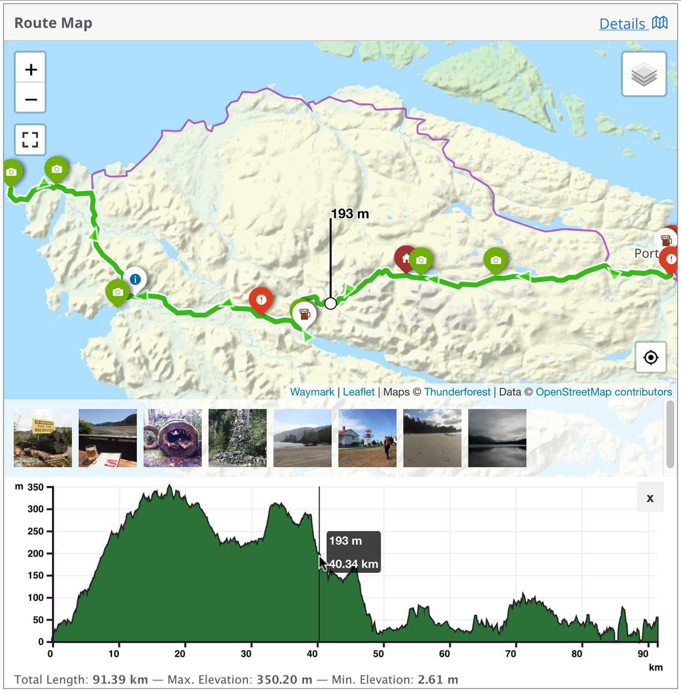
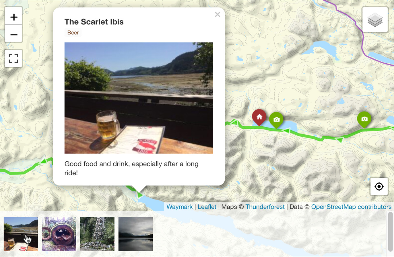
- Use the intuitive Editor to create Maps with one, or thousands of interactive Overlays.
- Create Markers, Lines, and Shapes with customizable Titles, Images, Descriptions, and Types.
- Import various formats like GPX, KML, GeoJSON, EXIF, and Elevation data.
- Add extra information to your Maps with customizable form inputs.
Displaying Maps
- Embed Maps using the [Waymark] Shortcode or link to the Map Details page.
- Display a single Map or a Collection of Maps anywhere Shortcodes are supported.
- Support for multiple raster tiled/“slippy” Basemaps with the ability to switch Basemaps using the Overlay Filter.
- Allow users to filter which Overlays are currently visible on the Map.
Customising
- Flexible settings to control how Overlays (Markers/Lines/Shapes) are displayed.
- Provide Marker Icons as Font Icons, Simple Text, Emojis, or Custom HTML.
- Most elements can be styled using CSS with sensibly named waymark- classes.
- Maps are displayed using the Leaflet JavaScript library, which can be extended using callback functions.
Export
- Optionally allow anyone to Export Maps into GPX, KML, and GeoJSON formats.
- Works on mobile devices.
- Export functionality can be accessed through the Shortcode Header or on the Map Details page.
Rating and reviews

zerider
24 Jun, 2024
Very powerful and useful plugin. And Support is very fast to answer and fix issues

Seremailragno.com
26 Mar, 2024
We have tried many plugin to add maps and gpx but this is the best that we have found. Congratulations!

kruemelbrot
07 Mar, 2024
Many thanks for this great plugin. It’s really rare to find something like this as open source. Nice to see that it is still being maintained. Thanks again for the great work!

hsmeets
22 Feb, 2024
A nice plugin to include maps/tracks on your website. We use it for our (road) cycling club so members can download the gpx of the group ride. We do not use all functionality like “rich” maps with markers and photo’s. We also not create maps within the plugin but reference the gpx file directly that is stored in the media section of WP. Support by the creator of this plugin is very good (in the odd case something does not work).

Simon Karvelas
21 Feb, 2024
I use this plugin to show maps for our cycling routes on our website and it is perfect. Twice when I needed support so far, Joe responded in minutes and problem solved.